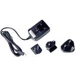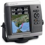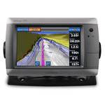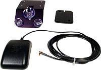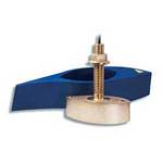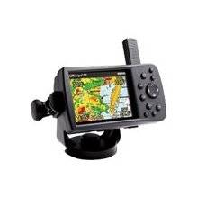
; from box to boat to dash with the portable and versatile GPSMAP 478. This combination color chartplotter and land navigator comes preloaded with U.S. marine charts utilizing elements of the latest BlueChart g2 technology, in addition to detailed street-level mapping. Optional weather and sonar capabilities combined with the ability to conveniently add plug-in data cards, let you easily add more maps and features - making this one incredible GPS navigator for land and sea. PRODUCT FEATURES: Accepts the latest (optional) BlueChart g2 data cards; Add optional GSD 21 for full-feature sonar capability; Add optional GXM 30 antenna for XM WX Satellite Weather; Provides tides and built-in celestial information; NMEA 0183 input and output; Removable quad helix antenna; Single knob tilt/swivel mount. « less
Product Specifications –
General
Accuracy : Position - 49 ft Position - 10 ft - 16 ft ( with DGPS ) Position - 10 ft ( with WAAS )Antenna : DetachableCompatible Software : MapSource BlueChart g2DGPS : DGPS readyFeatures : Optional external GPS antenna connection, built-in speakerFirst Seen On ;ogle Shopping : May 2006Included Software : MapSource Trip & Waypoint Manager, MapSource City Navigator North America NTInterface : USB, NMEA 0183Product Type : GPS receiverReceiver : 12 channelRecommended Use : MarineSBAS : WAASUpdate Rate : 1/secondVoice : Navigation instructions