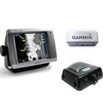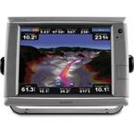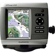
Offshore fishermen and boaters will gravitate toward this sleek, space-saving chartplotter. The GPSMAP 440 features preloaded detailed maps for the U.S. coast as well as an ultra-bright 4" QVGA display; built-in, satellite-enhanced worldwide basemap and simplified user operation. The 440 has preloaded detailed maps that cover all U.S. coastal areas, including Alaska and Hawaii. For areas outside the U.S., the 440 has a worldwide basemap with satellite images in place of more traditional maps, and its SD card slot makes it easy to add additional maps without connecting to a computer. With fewer keys and a simple, intuitive interface, the 440 makes navigating your way through the water easy. Where applicable, the sounder version, GPSMAP 440s, comes with a powerful dual frequency transducer that clearly paints depth contours, fish targets and structure. It's also CANet compatible, so you can share sounder data with another chartplotter on your boat. The weather-enabled versions, GPSMAP 440x and 440sx, display XM satellite weather data, including NEXRAD radar, with the GXM 31 antenna. « less
Product Specifications –
General
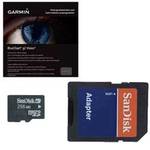
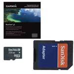
Accuracy : Position - 49 ft Velocity - 0.16 ft/sec Position - 10 ft ( with WAAS )Antenna : Built-inCard Reader : SD Memory CardCompatible Software : BlueChart g2 VisionDGPS : DGPS readyFeatures : Depth sounder, optional external GPS antenna connection, alarm, 2D / 3D map perspectiveFirst Seen On ;ogle Shopping : May 2007Functions & Services : MOB (Man Overboard)Grids : UTM, Lat/Lon, UPS, Loran TDs, MaidenheadInterface : NMEA 0183Preloaded Maps : USAProduct Type : GPS receiverReceiver : 12 channelRecommended Use : MarineSBAS : WAASUpdate Rate : 1/second